GeoSneakPique: Visual autocompletion for geospatial queries
Vidya Setlur, Sarah Battersby, Tracy Kam Hung Wong
External link (DOI)
View presentation:2021-10-27T13:00:00ZGMT-0600Change your timezone on the schedule page
2021-10-27T13:00:00Z
Fast forward
Direct link to video on YouTube: https://youtu.be/qKJtJHvtCQc
Keywords
Software Prototype, Geospatial Data
Abstract
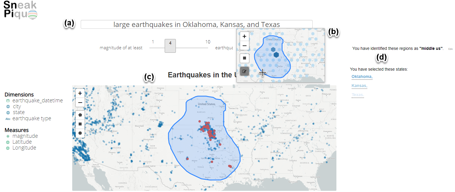
How many crimes occurred in the city center? And exactly which part of town is the ‘city center'? While location is at the heart of many data questions, geographic location can be difficult to specify in natural language (NL) queries. This is especially true when working with fuzzy cognitive regions or regions that may be defined based on data distributions instead of absolute administrative location (e.g., state, country). GeoSneakPique presents a novel method for using a mapping widget to support the NL query process, allowing users to specify location via direct manipulation with data-driven guidance on spatial distributions to help select the area of interest. Users receive feedback to help them evaluate and refine their spatial selection interactively and can save spatial definitions for re-use in subsequent queries. We conduct a qualitative evaluation of the GeoSneakPique that indicates the usefulness of the interface as well as opportunities for better supporting geospatial workflows in visual analysis tasks employing cognitive regions.