Cartographic Relief Shading with Neural Networks
Bernhard Jenny, Magnus Heitzler, Dilpreet Singh, Marianna Farmakis-Serebryakova, Jeffery Chieh Liu, Lorenz Hurni
External link (DOI)
View presentation:2020-10-29T16:00:00ZGMT-0600Change your timezone on the schedule page
2020-10-29T16:00:00Z
Keywords
Relief shading, shaded relief, hillshade, neural rendering, illustrative visualisation, image-to-image translation
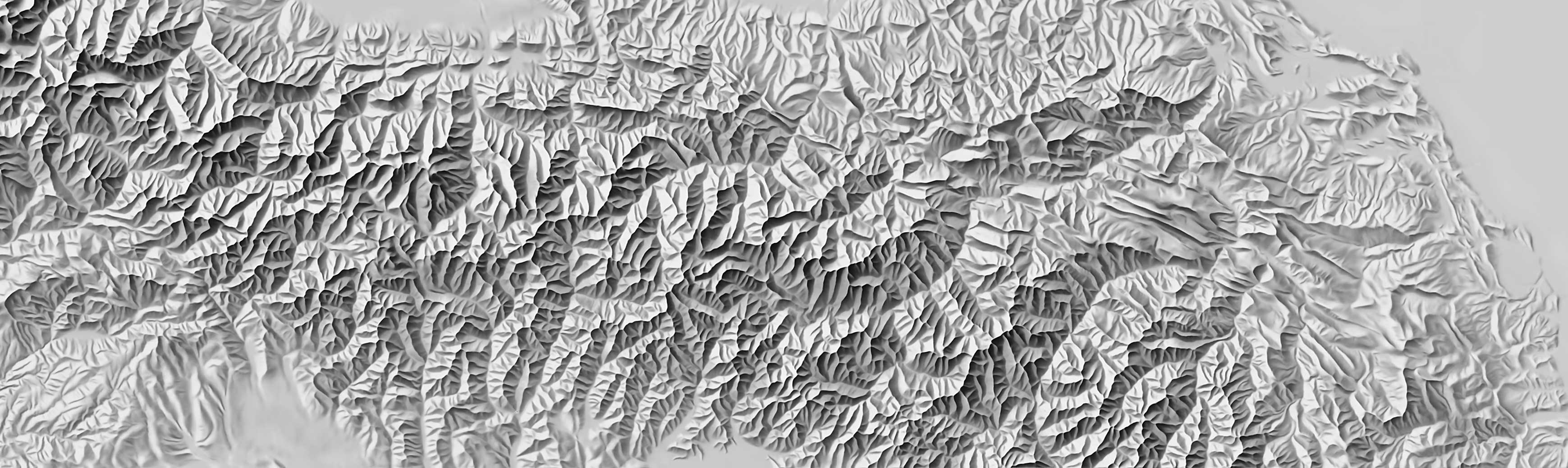
Abstract
Shaded relief is an effective method for visualising terrain on topographic maps, especially when the direction of illumination is adapted locally to emphasise individual terrain features. However, digital shading algorithms are unable to fully match the expressiveness of hand-crafted masterpieces, which are created through a laborious process by highly specialised cartographers. We replicate hand-drawn relief shading using U-Net neural networks. The deep neural networks are trained with manual shaded relief images of the Swiss topographic map series and terrain models of the same area. The networks generate shaded relief that closely resemble hand-drawn shaded relief art. The networks learn essential design principles from manual relief shading such as removing unnecessary terrain details, locally adjusting the illumination direction to accentuate individual terrain features, and varying brightness to emphasise larger landforms. Neural network shadings are generated from digital elevation models in a few seconds, and a study with 18 relief shading experts found that they are of high quality.