Visual Abstraction of Geographical Point Data with Spatial Autocorrelations
Zhiguang Zhou, Xinlong Zhang, Zhendong Yang, Yuhua Liu, Yuanyuan Chen, Ying Zhao, Wei Chen
External link (DOI)
View presentation:2020-10-30T14:45:00ZGMT-0600Change your timezone on the schedule page
2020-10-30T14:45:00Z
Keywords
Visual Abstraction, Spatial Autocorrelation, Sampling, Geospatial Analysis
Abstract
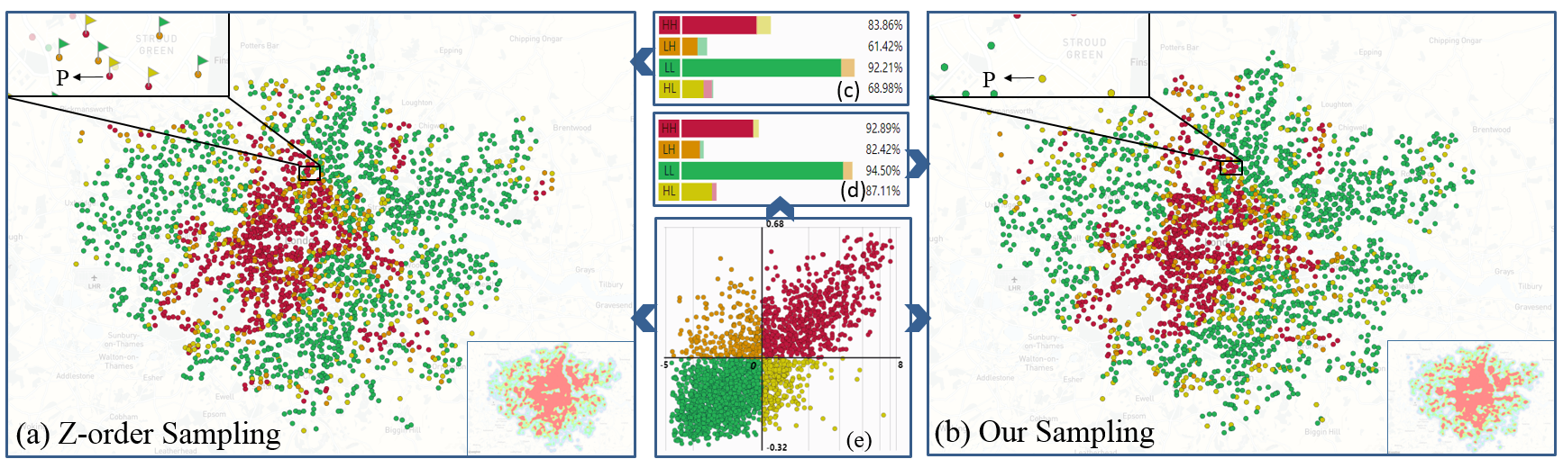
Scatterplots are always employed to visualize geographical point datasets, which often suffer from an overdraw problem due to the increase of data sizes. A variety of sampling strategies have been proposed to reduce overdraw and visual clutter with the spatial densities of points taken into account. However, informative attributes associated with the points also play significant roles in the exploration of geographical datasets. In this paper, we propose an attribute-based abstraction method to simplify the cluttered visualization of large-scale geographical points. Spatial autocorrelations are utilized to measure the attribute relationships of points in local areas, and a novel attribute-based sampling model is designed to generate a subset of points to preserve both density and attribute characteristics of original geographical points. A set of visual designs and user-friendly interactions are implemented, enabling users to capture the spatial distribution of geographical points and get deeper insights into the attribute features across local areas. Case studies and quantitative comparisons based on the real-world datasets further demonstrate the effectiveness of our method in the abstraction and exploration of large-scale geographical point datasets.