A Review of Geospatial Content in IEEE Visualization Publications
Alexander Yoshizumi, Megan M. Coffer, Elyssa L. Collins, Mollie D. Gaines, Xiaojie Gao, Kate Jones, Ian R. McGregor, Katie A. McQuillan, Vinicius Perin, Thom Worm, Laura M. Tomkins, Laura Tateosian
External link (DOI)
View presentation:2020-10-28T14:00:00ZGMT-0600Change your timezone on the schedule page
2020-10-28T14:00:00Z
Fast forward
Direct link to video on YouTube: https://youtu.be/5VEgymzE9VA
Keywords
geovisualization, cartography, mapping, geospatial analytics, spatial temporal
Abstract
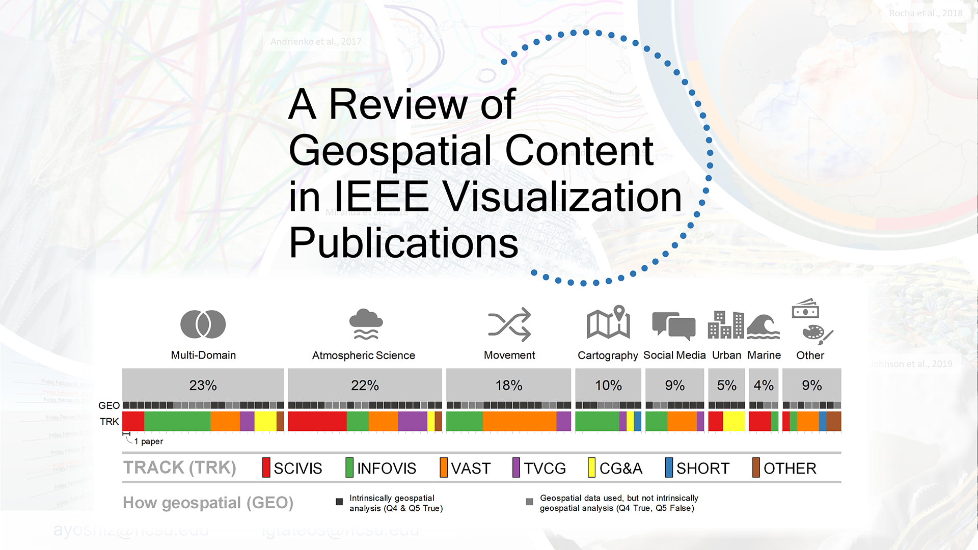
Geospatial analysis is crucial for addressing many of the world's most pressing challenges. Given this, there is immense value in improving and expanding the visualization techniques used to communicate geospatial data. In this work, we explore this important intersection – between geospatial analytics and visualization – by examining a set of recent IEEE VIS Conference papers (a selection from 2017-2019) to assess the inclusion of geospatial data and geospatial analyses within these papers. After removing the papers with no geospatial data, we organize the remaining literature into geospatial data domain categories and provide insight into how these categories relate to VIS Conference paper types. We also contextualize our results by investigating the use of geospatial terms in IEEE Visualization publications over the last 30 years. Our work provides an understanding of the quantity and role of geospatial subject matter in recent IEEE VIS publications and supplies a foundation for future meta-analytical work around geospatial analytics and geovisualization that may shed light on opportunities for innovation.