FSLens: A Visual Analytics Approach to Evaluating and Optimizing the Spatial Layout of Fire Stations
Longfei Chen, He Wang, Yang Ouyang, Yang Zhou, Naiyu Wang, Quan Li
DOI: 10.1109/TVCG.2023.3327077
Room: 106
2023-10-25T22:00:00ZGMT-0600Change your timezone on the schedule page
2023-10-25T22:00:00Z
Fast forward
Full Video
Keywords
Spatiotemporal Analysis, Multi-criteria Decision Making, Visualization.
Abstract
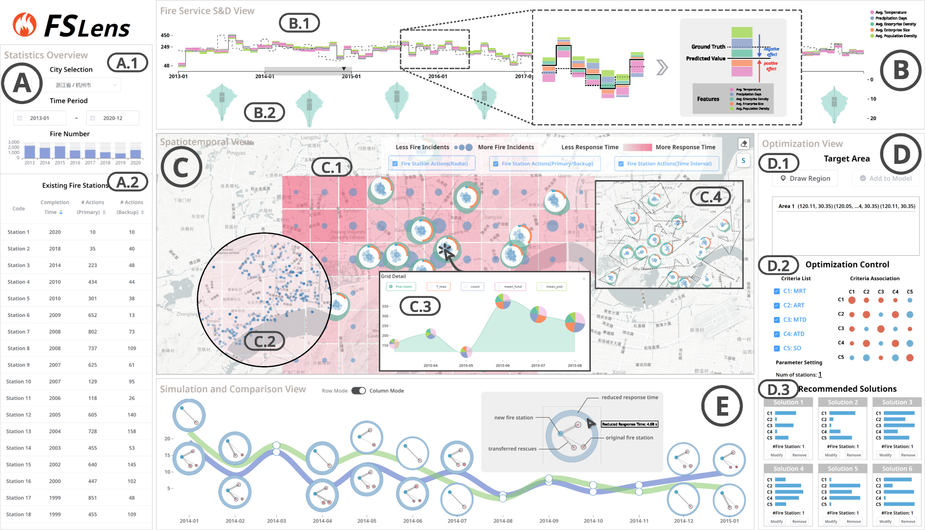
The provision of fire services plays a vital role in ensuring the safety of residents' lives and property. The spatial layout of fire stations is closely linked to the efficiency of fire rescue operations. Traditional approaches have primarily relied on mathematical planning models to generate appropriate layouts by summarizing relevant evaluation criteria. However, this optimization process presents significant challenges due to the extensive decision space, inherent conflicts among criteria, and decision-makers' preferences. To address these challenges, we propose FSLens, an interactive visual analytics system that enables in-depth evaluation and rational optimization of fire station layout. Our approach integrates fire records and correlation features to reveal fire occurrence patterns and influencing factors using spatiotemporal sequence forecasting. We design an interactive visualization method to explore areas within the city that are potentially under-resourced for fire service based on the fire distribution and existing fire station layout. Moreover, we develop a collaborative human-computer multi-criteria decision model that generates multiple candidate solutions for optimizing firefighting resources within these areas. We simulate and compare the impact of different solutions on the original layout through well-designed visualizations, providing decision-makers with the most satisfactory solution. We demonstrate the effectiveness of our approach through one case study with real-world datasets. The feedback from domain experts indicates that our system helps them to better identify and improve potential gaps in the current fire station layout.