Multilevel Visual Analysis of Aggregate Geo-Networks
Zikun Deng, Shifu Chen, Xiao Xie, Guodao Sun, Mingliang Xu, Di Weng, Yingcai Wu
DOI: 10.1109/TVCG.2022.3229953
Room: 105
2023-10-26T22:24:00ZGMT-0600Change your timezone on the schedule page
2023-10-26T22:24:00Z
Fast forward
Full Video
Keywords
Geospatial network;multilevel analysis;information visualization;graph drawing
Abstract
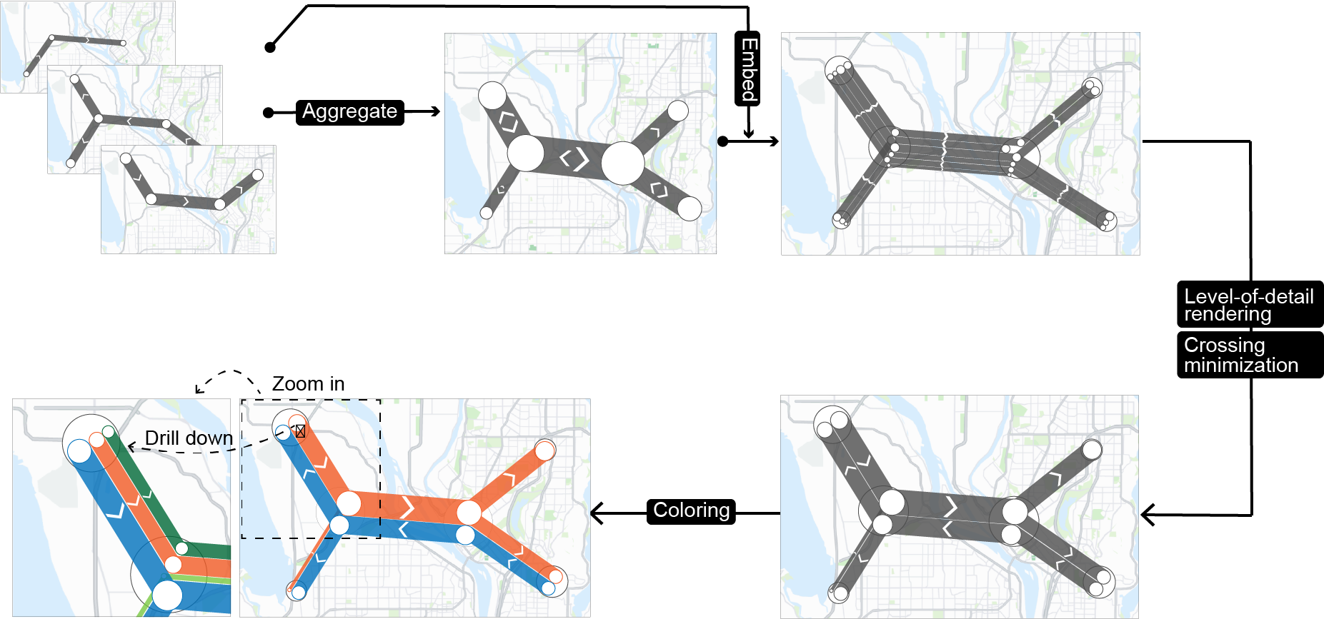
Numerous patterns found in urban phenomena, such as air pollution and human mobility, can be characterized as many directed geospatial networks (geo-networks) that represent spreading processes in urban space. These geo-networks can be analyzed from multiple levels, ranging from the macro-level of summarizing all geo-networks, meso-level of comparing or summarizing parts of geo-networks, and micro-level of inspecting individual geo-networks. Most of the existing visualizations cannot support multilevel analysis well. These techniques work by: 1) showing geo-networks separately with multiple maps leads to heavy context switching costs between different maps; 2) summarizing all geo-networks into a single network can lead to the loss of individual information; 3) drawing all geo-networks onto one map might suffer from the visual scalability issue in distinguishing individual geo-networks. In this study, we propose GeoNetverse, a novel visualization technique for analyzing aggregate geo-networks from multiple levels. Inspired by metro maps, GeoNetverse balances the overview and details of the geo-networks by placing the edges shared between geo-networks in a stacked manner. To enhance the visual scalability, GeoNetverse incorporates a level-of-detail rendering, a progressive crossing minimization, and a coloring technique. A set of evaluations was conducted to evaluate GeoNetverse from multiple perspectives.