Visual Communication of Aftershock Forecasts Based on User Needs: A Case Study of the US, Mexico and El Salvador
Max Schneider, Anne Wein, Nicholas van der Elst, Sara K. McBride, Julia Becker, Raul R Castro, Manuel Diaz, Hector Gonzalez-Huizar, Jeanne Hardebeck, Andrew Michael, Luis Ernesto Mixco, Morgan Page, Jocelyn I Palomo
Room: 105
2023-10-22T03:00:00ZGMT-0600Change your timezone on the schedule page
2023-10-22T03:00:00Z
Fast forward
Full Video
Keywords
Evaluation—Human-Subjects Qualitative Studies Human Factors—General Public Applications—Physical & Environmental Sciences, Engineering, Mathematics
Abstract
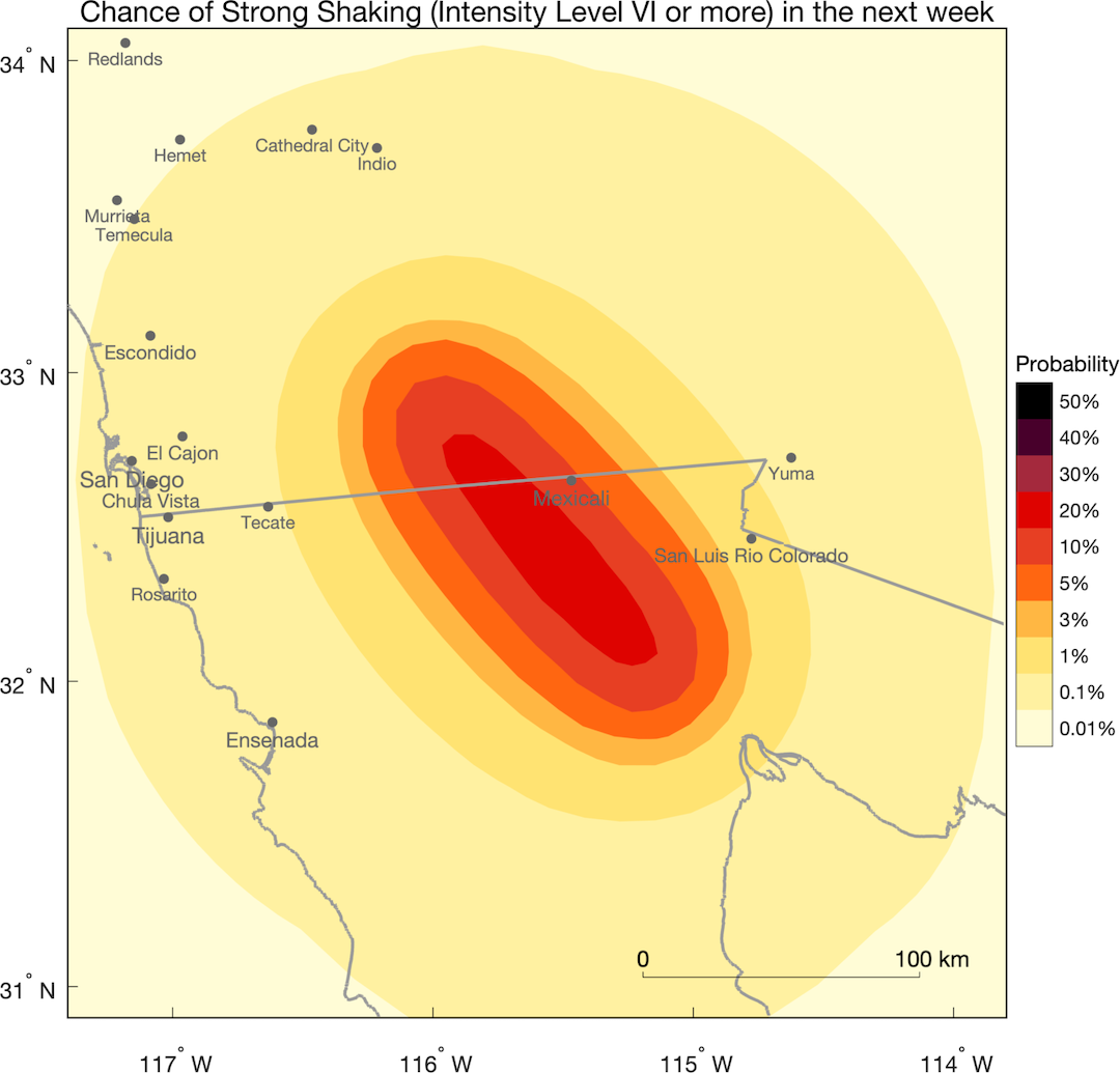
Aftershock forecasts can help reduce seismic risk by communicating how many aftershocks can be expected following a large earthquake, and how the expected number of aftershocks evolves over time and space. Prior work finds that graphical forecast products may better communicate this information than only text or numbers. To identify which visual products can serve numerous user groups, we held workshops with members of target professions, including emergency managers, engineers, critical infrastructure operators, science com- municators, and more. We conducted these workshops in the U.S., Mexico and El Salvador to understand which forecast products may be effective across countries. Many users reported needing maps of shaking hazard to support their work. We find a greater variation in user needs across professions than country, and that user needs also vary with time. We discuss the practical implications for effective visual communication of aftershock forecasts and natural hazards.