Paths through Spatial Networks
Alex Godwin
View presentation:2022-10-19T19:45:00ZGMT-0600Change your timezone on the schedule page
2022-10-19T19:45:00Z
Prerecorded Talk
The live footage of the talk, including the Q&A, can be viewed on the session page, Visualization Systems and Graph Visualization.
Keywords
Human-centered computing—Visualization—Visualization techniques—Graph Drawing; Human-centered computing—Visualization—Visualization application domains—Geographic visualization
Abstract
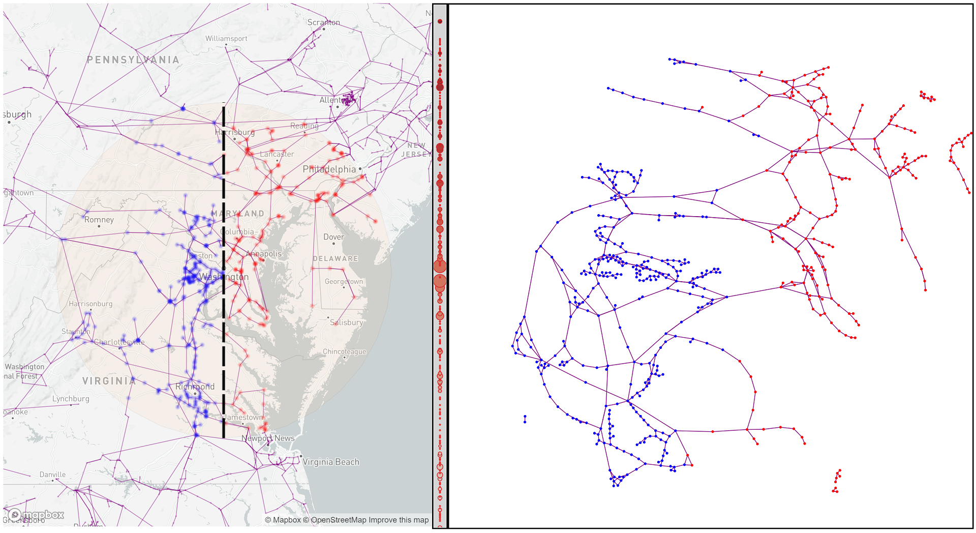
Spatial networks present unique challenges to understanding topological structure. Each node occupies a location in physical space (e.g., longitude and latitude) and each link may either indicate a fixed and well-described path (e.g., along streets) or a logical connection only. Placing these elements in a map maintains these physical relationships while making it more difficult to identify topological features of interest such as clusters, cliques, and paths. While some systems provide coordinated representations of a spatial network, it is almost universally assumed that the network itself is the sole mechanism for movement across space. In this paper, I present a novel approach for exploring spatial networks by orienting them along a point or path in physical space that provides the guide for parameters in a force-directed layout. By specifying a path across topography, networks can be spatially filtered independently of the topology of the network. Initial case studies indicate promising results for exploring spatial networks in transportation and energy distribution.