Real-Time Visualization of Large-Scale Geological Models with Nonlinear Feature-Preserving Levels of Detail
Ronell Sicat, Mohamed Ibrahim, Amani Ageeli, Florian Mannuss, Peter Rautek, Markus Hadwiger
View presentation:2022-10-21T14:00:00ZGMT-0600Change your timezone on the schedule page
2022-10-21T14:00:00Z
Prerecorded Talk
The live footage of the talk, including the Q&A, can be viewed on the session page, Spatial Data.
Fast forward
Keywords
Geological model visualization, Structured hexahedral meshes, Multiresolution representations and visualization, GPU data structures and rendering
Abstract
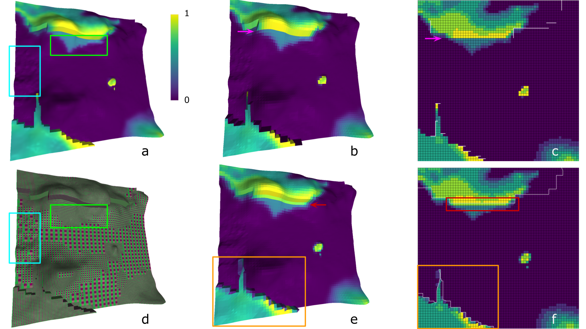
The rapidly growing size and complexity of 3D geological models has increased the need for level-of-detail techniques and compact encodings to facilitate interactive visualization. For large-scale hexahedral meshes, state-of-the-art approaches often employ wavelet schemes for level of detail as well as for data compression. Here, wavelet transforms serve two purposes: (1) they achieve substantial compression for data reduction; and (2) the multiresolution encoding provides levels of detail for visualization. However, in coarser detail levels, important geometric features, such as geological faults, often get too smoothed out or lost, due to linear translation invariant filtering. The same is true for attribute features, such as discontinuities in porosity or permeability.We present a novel, integrated approach addressing both purposes above, while preserving critical data features of both model geometry and its attributes. Our first major contribution is that we completely decouple the computation of levels of detail from data compression, and perform nonlinear filtering in a high-dimensional data space jointly representing the geological model geometry with its attributes. Computing detail levels in this space enables us to jointly preserve features in both geometry and attributes. While designed in a general way, our framework specifically employs joint bilateral filters, computed efficiently on a high-dimensional permutohedral grid. For data compression, after the computation of all detail levels, each level is separately encoded with a standard wavelet transform. Our second major contribution is a compact GPU data structure for the encoded mesh and attributes that enables direct real-time GPU visualization without prior decoding.